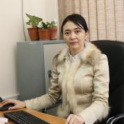
Imansakipova Botakoz
Ph.D.
Associate Professor
Mining and Metallurgical Institute named after O.A. Baikonurov
Department of Surveying and Geodesy
Email: b.imansakipova@satbayev.111
Professional biography
Associate Professor of the Department of "Surveying and Geodesy", PhD Mining engineer-surveyor, teacher with more than 15 years of experience. Academician of the National Academy of Mining Sciences of the Republic of Kazakhstan, Head and performer of numerous scientific projects, author of more than 40 scientific papers, including 2 monographs. Scientific Secretary of the Dissertation Council doctor PhD in the specialties "Geodesy" and "Mining" at Satbayev University. Member of the Union of Surveyors of Kazakhstan, the International Federation of Surveyors. Head of scientific projects and contractual work with the largest mining enterprises of the Republic of Kazakhstan and with the corporation "BI-Group".
Education
1. 1998-2003 - K. I. Satpayev Kazakh National Technical University, Mining Faculty, full-time department of Surveying. Qualification-Mining engineer-surveyor.
2. 2004-2006 - Kazakh Head Architectural and Construction Academy named after K. Ryskulbekov, Geodesy and Cartography. Academic degree - Master of Technical Sciences.
3. 2011-2014 - Kazakh National Technical University named after K. I. Satpayev, Mining Faculty, specialty 6D071100-Geodesy. Academic stenen - Doctor of PhD
Scientific projects
According to State grants of the Ministry of Education and Science of the Republic of Kazakhstan, a project on the topic is being implemented:
1. 1059/GF4 "Development of minerals in weakened zones with the support of geomechanical monitoring based on innovative surveying, topographic and geodetic and aerospace technologies" - Chief Researcher;
2. AP05131789 "Geoinformation system for managing technogenic risks in conditions of high agglomerative load using topographic, geodetic and aerospace methods" - Scientific supervisor;
3. AP08053410 "Development of innovative methods for forecasting and assessing the state of a rock mass for the prevention of man-made emergencies" - leading researcher
Publications
1. Imansakipova B.B., Chernov A.V., Kidirbaev B.I., Kakimzhanov E.Kh. Improving the effectiveness of monitoring the earth's surface on the territory of the Annensky deposit using space radar interferometry (CWI) - 2019. Moscow, Mine Surveying and Subsoil Use
2. B. B. Imansakipova, A. V. Chernov, E.Kh. Kakimzhanov, J.D. Baigurin. Improving the effectiveness of geographic information systems through the use of Big Data technologies. Proceedings of the international scientific-practical conference "The rational use of mineral and industrial raw materials in the conditions of Industry 4.0" - Almaty: KazNITU, 2019. - P.132-135 (Rakishev conference)
3. Imansakipova B. B., Chernov A. V., Kidirbaev B. I., Mustafin M. G. Increasing the efficiency of flood assessment using data from radar interferometry and GIS technologies - International Mine Survey Forum (Karaganda)
4. Kidirbaev BI, Kakimzhanov E.Kh., Imansakipova NB, Kosnikov VA. Specialized geographic information system for managing technological risks during the construction and operation of ground and underground structures. Mining Journal of Kazakhstan №2
5. Е.А. Сдвижкова, К.В. Кравченко, Б.Б. Имансакипова, Г.С.Шакиева. Повышение эффективности комбинированного метода ранжирования участков трассы метро по степени проблемности // Горный журнал Казахстана, №8, 2020, - С.18-25 http://minmag.kz/ru/archive_dates/2020/?lang=ru_RU
6. Б.Б.Имансакипова, П.А.Московчук, Г.С.Шакиева, Б.Кидирбаев. Ранжирование участков трассы метро по степени проблемности на основе комбинированного метода оценки факторов риска и их уровней // Горный журнал Казахстана, №5-6, 2020 http://minmag.kz/ru/archive_dates/2020/?lang=ru_RU
7. B.B.Imansakipova, O.O.Sdvyzhkova, Sh.K.Aitkazinova, K.Z.Isabayev, G.Shakieva. The combined method for assessing risk factors in underground construction // Naukovyi Visnyk Natsionalnoho Hirnychoho Universytetu, 2020, № 3 http://nvngu.in.ua/index.php/en/archive/on-the-issues/1844-2020/contens-3-2020/5337-the-combined-method-for-assessing-risk-factors-in-underground-construction
| № | Article title | Journal title | Direction | Year |
|---|
Potential research studies of doctoral students
1. Forecast and spatio-temporal localization of the failure hazard of the Earth's surface during the development of minerals
2. Investigation of the state and properties of the mountain massif by seismoacoustic methods


